Floodplain Information
Find out if your property (within the Town of Oro Valley) is in or near a floodplain
The Floodplain Inquiry Map is available by simply entering your address into the property search box in the map. However, the information obtained through the Floodplain Inquiry Map is not an official flood zone determination for flood insurance purposes. For assistance with the map, please contact 520-229-4879.
An official floodplain determination can be provided by submitting your request through the Oro Valley Customer Portal. A fee of $15.00 is required to provide this determination.
Disclaimer: While using the Customer Portal, you will see it refers to Permits. Your final document informing you of the floodplain status of the lot will be titled as a Permit. The word permit is only being used because the portal system we are using to process this request is also the primary software for issuing building permits. However, the information provided in the document is not a permit to build. The floodplain determination provides results of the floodplain status for the property.
In the Customer Portal, create an account or log in with an existing account.
Once you've logged in, go to My Portal:

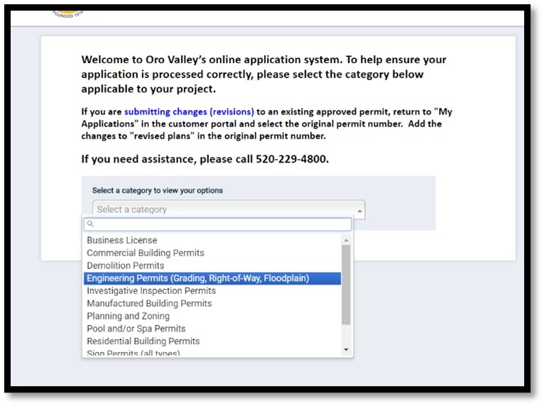
Apply Online:

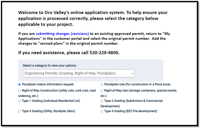
Select the category of Engineering Permits
Choose the Floodplain Status Information Request option:
Continue to complete the required fields in the portal and click the Submit Application button and pay the $15.00 fee.
Requests are generally answered in 5 to 7 business days.
When the results of your request are complete, the portal will email you with a message for you to "Issue My Permit". The document will be available for you to print: